Geography
Map Puzzle
R 100.00
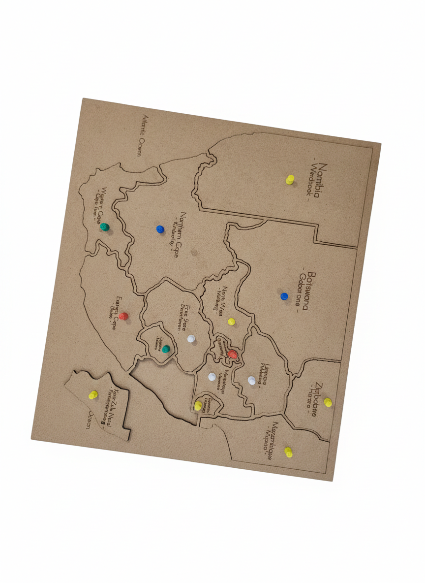
Explore Mzansi: The Ultimate South Africa Map Puzzle
Bring Geography to life (literally!) with this tactile, laser-cut masterpiece. Toss out the flat textbooks and let your learners get hands-on with the provinces, capitals, and neighbors of South Africa. Designed to align with the Social Sciences curriculum, this puzzle isn’t just a toy—it’s a roadmap to mastering our beautiful corner of the world.
Why Teachers & Parents Love It:
* Tactile Learning: Every province is a precision-cut piece, helping children develop spatial awareness and fine motor skills as they "build" the country.
*Pinned for Success: Includes markers for identifying provincial capitals and neighboring countries (hello, Namibia and Botswana!).
* Curriculum Aligned: Perfect for Grade 4–7 Social Science lessons on map skills and South African geography.
* EduCut Quality: Crafted from durable, sustainably sourced wood—built to survive even the most "energetic" classroom environments.
What’s in the box?
1 x Precision laser-cut South African base map.
9 x Pop-out Province pieces.
6 x Pop-out Neighboring countries pieces.
"From Limpopo to the Cape, give your little explorers the best start in Geography."